Your photos, some GPS tracks ... You do not need more.
Geolocate your photos
Because not all devices have an integrated GPS
Simple & Intuitive
Select a directory with your images and the corresponding GPS traces (gpx files or kml, kmz). He does the rest.
Visual & interactive
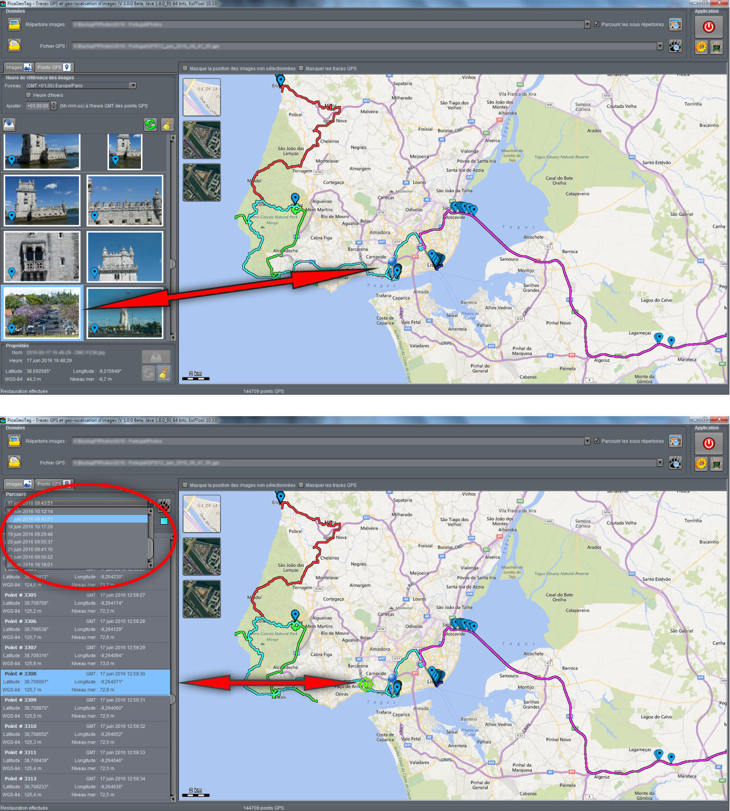
Locate and adjust the position of your images directly on a map, following GPS track or not.
Altitudes or Elevation
Sea Level or Geoïde WGS-84? It's not always obvious, but it does not matter, it's planned!
Security
Because your images are valuable, they can be saved automatically.
How it works?
Even though this is evolving, not all cameras have built-in GPS. Recording GPS coordinates (latitude and longitude) and sometimes elevation in images, can nevertheless be very handy for classifying them or simply to find the exact location where an image was taken. To "geotag" your photos, nothing more simple. You only need a device capable of recording your trip while you are taking your pictures (a smartphone with a GPS application like GeoTrack for example). PicaGeoTag will then compare the date and time of your photos with the date and time of the points recorded by the GPS device to determine the position of the shot. The location are then saved in the metadata of the image.
MAIN CHARACTERISTICS
Batch Processing
Process all images at once. The individual recording of the images remains of course possible.
Selective
If images are already geolocated, they are not modified (unless they are reset).
Adjustable
Your camera time was not perfectly set! No problem. Adjust the offset with GPS tracks to correct positions.
Real Altitudes
There are several references for altitudes (Normally sea level for KML files and WGS-84 for GPX files). PicaGeoTag gives you the choice.