The Android application Calibration PicaGeoTag automatically synchronizes GPS paths with images.
The principle is as follows:
Take a photo of the application screen with your camera.
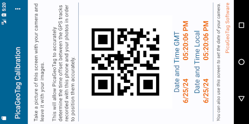
Copy this image with your photos to a directory. Add the GPS files and run PicaGeoTag.
The software will detect the picture of the calibration screen and adjust the difference between the date of your phone and the one of your camera. Your images will then be marked very accurately.
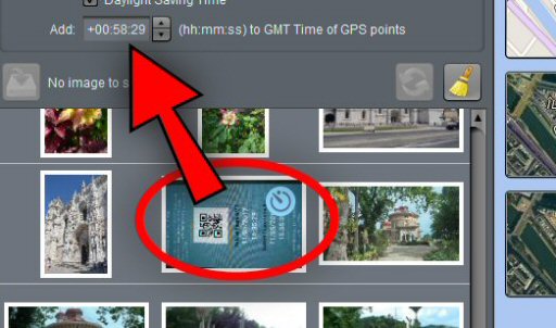
The software must analyze each image, which can take time if there are a lot of images.
Recent Comments