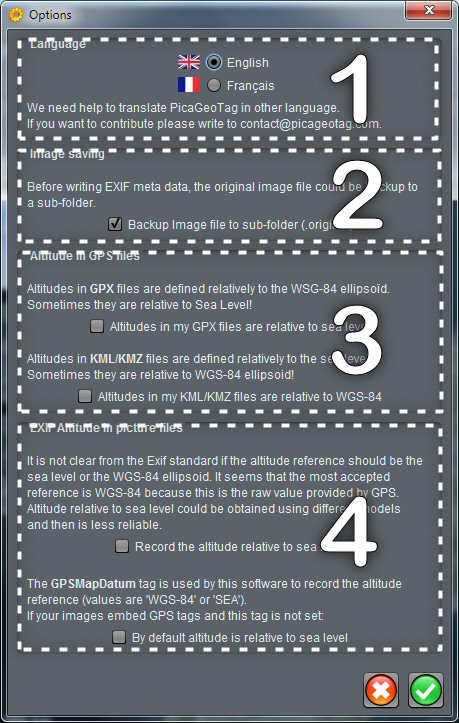
 The configuration screen is used to define:
- The language used by the software.
- The option to save original images.
- The altitude reference used in your GPS files.
- The altitude reference to use when recording images.
 Language
Currently the software supports English and French.
A change of language requires a relaunch of the software.
If you would like to help us translate this software into other languages, do not hesitate to write us. Thank you in advance.
 Backup original images
As a precaution, the original images can be saved before modification. They are copied to a .original subdirectory.
 Reference for altitude in GPS files
There are several references for altitudes. The software recognizes two GPS file formats that each have their own references. Unfortunately, some GPS trackers do not strictly follow the standards.
These options allow you to stick to the reference used by your GPS files.
 Référence for altitude in EXIF
The EXIF standard does not specify the reference to be used for altitude recording. PicaGeoTag uses the WGS-84 ellipsoid but you can choose to record altitudes relative to sea level.
In any case, the reference used is saved in the GPSMapDatum tag. If you already have images with GPS data, and this tag does not exist, you can specify the reference to use (by default PicaGeoTag uses WGS-84).
Recent Comments