The map is used to view the position of GPS images and traces.
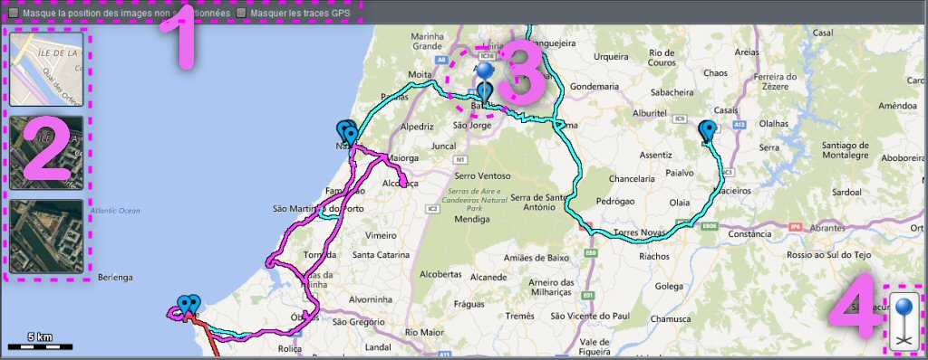
The position of the loaded images is indicated with a blue mark ![]() for images whose data has not been changed, and a red mark
for images whose data has not been changed, and a red mark ![]() for those that have been modified (but have not yet been recorded).
for those that have been modified (but have not yet been recorded).
If multiple GPS tracks have been loaded, they appear in different colors
 Display Control
The two check boxes are used to hide the position of unselected images and/or GPS tracks.
 Map type
These buttons allow you to choose the map type: Plan, Mixed or Satellite.
The zoom level is controlled with the mouse wheel.
 Selected image position
This marker indicates the position of the selected image in the list if it has GPS coordinates.
It is possible to move it with the mouse to adjust the position if necessary.
 Manual marker
This icon is displayed only if the selected image does not have GPS coordinates.
It is possible to move it with the mouse to position the image and assign coordinates.
Recent Comments